SWARM PEDESTRIAN FLOWS SIMULATION
Development of software for the analysis of urban environment and design process optimization
May – June 2018
SWARM is a multi-agent system, a mathematical simulation of pedestrian flows, which visualizes their distribution on the territory to be designed.
This tool works to create a prediction of how pedestrian flows are going to be distributed within the territory of a project. It also assesses their density and reveals how popular the attractors are.
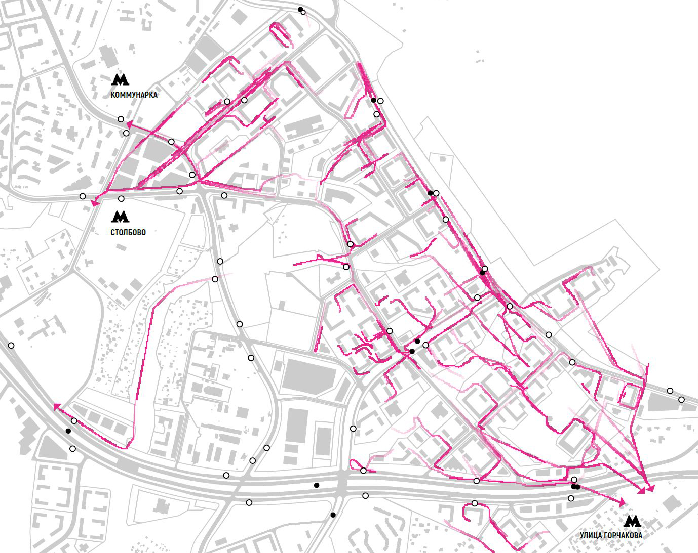
Mathematical simulation of pedestrian flows calculates their optimal distribution on the territory of a residential district. The simulation illustrates a piece of an episode of a 24-hour migration: a morning rush hour during the working week. The site plan and the territorial development plan were used to locate the sources of flows—emitters (exits from residential groups)—and the points to which the flow draws—attractors (public transport stops). Combining this information with the information on population density of each residential quarter and housing group, as well as topology of street network, it is possible to define trajectories and assess relative power / intensity of pedestrian flows within this episode.
The following rules were accepted for this simulation: agents (users) move towards the nearest attractors (points of attraction); agents cannot cross obstacles; intensity of emitters (sources of flows) are proportional to volumes of residential groups.